Eagle Island - Sep 14, 2005
At 11:45am Sean and I shoved off of Tyee with light winds and cloudy skies. The temperature was about 50 degrees and the boat was packed for the night. We started off west bound looking for the flood tide. Puget Sound has one of the largest tides in the US and the currents squeeze through the Tacoma Narrows to flood into the south sound.
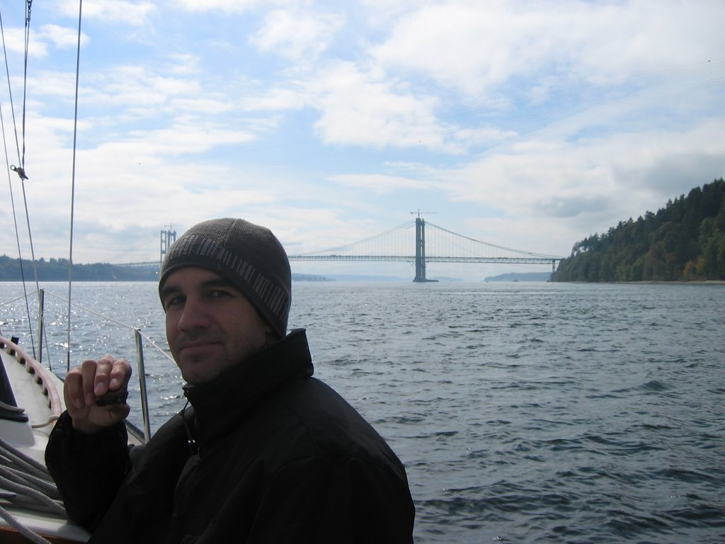
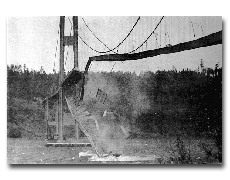 We timed the tide to pass under the bridge and get the best push we could. The Tacoma Narrows Bridge is a mile-long suspension bridge with a main span of 2800 foot (the third-largest in the world when it was first built) that carries Washington State Route 16 across the Tacoma Narrows of Puget Sound from Tacoma to Gig Harbor, Washington. The original bridge became famous for a dramatic filmed structural collapse in 1940. The replacement bridge opened in 1950.
  Construction of a new span, which will run parallel to the current bridge, began on October 4, 2002, and is scheduled to be completed in 2007. As we turned south west under the bridge the push really kicked in. Hoku Pa'a will do about 6kts under power and we were showing 11.5kts on the GPS. As we ripped south, Sean served a lunch of wraps and apples. Our wind dropped of around 2:30pm and the tide was calming down. Sean and I amused ourselves by hoisting each other to the top of the mast in his "airchair".We got some great pictures from the 45 feet up and the day was warming up to around 65 degrees. After a few hours of drifting on the tide we started up the engine and passed McNeil Island. The United States government bought land on McNeil Island in 1870 and opened a prison for Washington Territory there in 1875.
 It became a federal penitentiary when Washington became a state in 1889. Washington state took over the penitentiary from the federal government in 1981. It is now called McNeil Island Corrections Center. According to the state, it is the only facility in the U.S. to have been a territorial, federal, and state prison, and is the only prison left in North America that is only accessible by boat or air. As we approached eagle from the south circled around to the northwest.
 Eagle island is 10 acres and is a Washington State Marine Park. Sean and I tied off to one of three public mooring buoys and pumped up the dinghy. We rowed the short distance to the island and took a walk around the 2,600 feet of shore line. It was high tide and we had to duck under trees and walk in the water much of the way. There are many trails criss crossing the island but after reading a warning about poison oak we decided to stay off the overgrown trails. Eagle island was once a Indian burial ground where burial canoes were placed in trees around the island. After our exploration of the island we went back to the boat for an evening sail around the island and dinner.
posted by Hoku Pa'a at 8:54 PM
![]()

0 Comments:
Post a Comment
<< Home